
Thank you for supporting this site ❤️
Make a donation
Make a donation
Gear up for your next adventure:
As an Amazon Associate, this site earns from qualifying purchases at no extra cost to you.
Yusuhara topographic map
Click on the map to display elevation.
Thank you for supporting this site ❤️
Make a donation
Make a donation
Gear up for your next adventure:
As an Amazon Associate, this site earns from qualifying purchases at no extra cost to you.
About this map
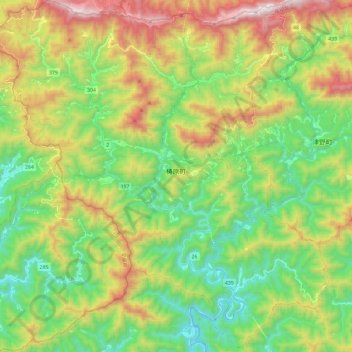
Name: Yusuhara topographic map, elevation, terrain.
Location: Yusuhara, Takaoka County, Kochi Prefecture, Japan (33.28218 132.80646 33.47920 133.03552)
Average elevation: 662 m
Minimum elevation: 213 m
Maximum elevation: 1,444 m
Thank you for supporting this site ❤️
Make a donation
Make a donation
Gear up for your next adventure:
As an Amazon Associate, this site earns from qualifying purchases at no extra cost to you.