Geolocate

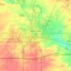
Cameron topographic map

Click on the map to display elevation.

About this map

Name: Cameron topographic map, elevation, terrain.

Location: Cameron, Bath Township, Cerro Gordo County, Iowa, 50401, United States (43.06258 -93.20861 43.10258 -93.16861)

Average elevation: 369 m

Minimum elevation: 354 m

Maximum elevation: 379 m

Other topographic maps

Click on a map to view its topography, its elevation and its terrain.
Clear Lake

United States > Iowa > Cerro Gordo County

Average elevation: 373 m

Mason City

United States > Iowa > Cerro Gordo County

Average elevation: 352 m

Mason City

United States > Iowa > Cerro Gordo County

Average elevation: 352 m

Rockwell

United States > Iowa > Cerro Gordo County

Average elevation: 343 m

Rockwell

United States > Iowa > Cerro Gordo County

Average elevation: 343 m

Clear Lake

United States > Iowa > Cerro Gordo County

Average elevation: 373 m

Rock Falls

United States > Iowa > Cerro Gordo County

Average elevation: 342 m

Clear Lake

United States > Iowa > Cerro Gordo County

Average elevation: 373 m

Rockwell

United States > Iowa > Cerro Gordo County

Average elevation: 343 m

Gear up for your next adventure:

🎽Hiking Clothing - Breathable clothing for hiking
🛰️Handheld GPS Units - Rugged GPS devices for tracking coordinates and elevation in the Australian bush
🧴SPF 50+ Bulk Sunscreen - Maximum protection for long-term outdoor exposure
🍴Titanium Spork & Cutlery - Indestructible and feather-light eating utensils
🪢550 Survival Paracord - Versatile cordage for gear repair and emergency lashing

As an Amazon Associate, this site earns from qualifying purchases at no extra cost to you.