
Blaßberg topographic map
Interactive map
Click on the map to display elevation.
About this map
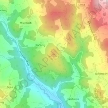
Name: Blaßberg topographic map, elevation, terrain.
Average elevation: 699 m
Minimum elevation: 548 m
Maximum elevation: 907 m
Other topographic maps
Click on a map to view its topography, its elevation and its terrain.
Affenberg
Österreich > Oberösterreich > Bezirk Urfahr-Umgebung > Haibach im Mühlkreis
Affenberg, Haibach im Mühlkreis, Bezirk Urfahr-Umgebung, Oberösterreich, 4204, Österreich
Average elevation: 726 m