Geolocate

Hildesheim topographic map

Click on the map to display elevation.

About this map
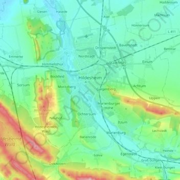
Name: Hildesheim topographic map, elevation, terrain.

Location: Hildesheim, Landkreis Hildesheim, Lower Saxony, Germany (52.09358 9.84655 52.19391 10.04280)

Average elevation: 120 m

Minimum elevation: 66 m

Maximum elevation: 298 m

Other topographic maps

Click on a map to view its topography, its elevation and its terrain.

Söhre

Germany > Lower Saxony > Landkreis Hildesheim

Average elevation: 139 m

Barienrode

Germany > Lower Saxony > Landkreis Hildesheim

Average elevation: 111 m

Mehle

Germany > Lower Saxony > Landkreis Hildesheim > Elze

Average elevation: 109 m

Gear up for your next adventure:

📟Satellite Messengers - Two-way satellite communication to stay in touch beyond the cellular grid
👣Snake & Scrub Gaiters - Protection against spinifex, mud, and snakes while walking off-track
🛌Sleeping Bags - Sleeping bags for outdoor camping
🧣Merino Neck Gaiters - Versatile headwear for warmth, sun protection, or dust filtering
🐍Australian Snake Bite Kits - Specific pressure immobilization bandages for Australian venomous snakes

As an Amazon Associate, this site earns from qualifying purchases at no extra cost to you.