
Bay Islands topographic map
Interactive map
Click on the map to display elevation.
About this map
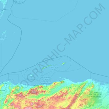
Name: Bay Islands topographic map, elevation, terrain.
Location: Bay Islands, Honduras (15.89251 -87.30371 17.61952 -83.69298)
Average elevation: 110 m
Minimum elevation: -3 m
Maximum elevation: 2,249 m
Guanaja is the second largest and is even more mountainous than Roatan. "Guanaja presents a mixture of the topographic and geologic features that characterize the two other large islands. This island is roughly divided into three sections by a series of hilltops, the highest of which rises to over 350 m above sea level, the highest elevation of the Bay Islands. These hilltops include important deposits of granite, marble, and serpentine." "In between these hills are moderately-sized alluvial plains that cut across these deposits, which have been densely populated since prehistory."
Other topographic maps
Click on a map to view its topography, its elevation and its terrain.