
Oberwürzbach topographic map
Interactive map
Click on the map to display elevation.
About this map
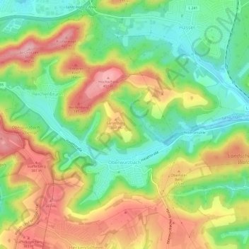
Name: Oberwürzbach topographic map, elevation, terrain.
Average elevation: 314 m
Minimum elevation: 237 m
Maximum elevation: 407 m
Other topographic maps
Click on a map to view its topography, its elevation and its terrain.
Wallburg
Deutschland > Saarland > Saarpfalz-Kreis > St. Ingbert
Wallburg, Hochscheidstraße, Reichenbrunn, Oberwürzbach, St. Ingbert, Saarpfalz-Kreis, Saarland, 66386, Deutschland
Average elevation: 309 m