
유성구 topographic map
Interactive map
Click on the map to display elevation.
About this map
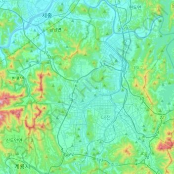
Name: 유성구 topographic map, elevation, terrain.
Location: 유성구, Daejeon, Corea del Sur (36.26448 127.24632 36.49988 127.41872)
Average elevation: 126 m
Minimum elevation: 8 m
Maximum elevation: 722 m