
Make a donation
Gear up for your next adventure:
As an Amazon Associate, this site earns from qualifying purchases at no extra cost to you.
Villarrica topographic map
Click on the map to display elevation.
Make a donation
Gear up for your next adventure:
As an Amazon Associate, this site earns from qualifying purchases at no extra cost to you.
Villarrica
The soils of the urban area are mainly sandy hills, with gentle slopes in the northern area and slightly steeper slopes in the south. Good drainage and no rockiness are also observed. Both in the urban area of Villarrica and in 14 de Mayo area (on the way to Ñumí) you can find ferruginous laterites and they occur in thick layers that support small topographic elevations. Due to the heavy deforestation, one can observe primitive tree species almost exclusively in areas of difficult access such as banks of streams. A great variety of grasses and palm trees grow In its terrain of undulating plains,. Grass can be natural grasslands or cultivated in order to feed cattle. The current extension of the palm groves is small but is increasing due to soil degradation.
Make a donation
Gear up for your next adventure:
As an Amazon Associate, this site earns from qualifying purchases at no extra cost to you.
About this map
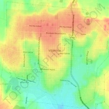
Name: Villarrica topographic map, elevation, terrain.
Location: Villarrica, Guairá, Región Oriental, 040103, Paraguay (-25.80302 -56.47074 -25.76220 -56.42414)
Average elevation: 160 m
Minimum elevation: 127 m
Maximum elevation: 188 m
Make a donation
Gear up for your next adventure:
As an Amazon Associate, this site earns from qualifying purchases at no extra cost to you.