Geolocate

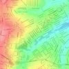
Jardim Rio Dourado topographic map

Click on the map to display elevation.

About this map

Name: Jardim Rio Dourado topographic map, elevation, terrain.

Location: Jardim Rio Dourado, Aparecida de Goiânia, Região Geográfica Imediata de Goiânia, Região Geográfica Intermediária de Goiânia, Goiás, Região Centro-Oeste, Brasil (-16.82963 -49.37352 -16.82440 -49.36888)

Average elevation: 823 m

Minimum elevation: 781 m

Maximum elevation: 867 m

Other topographic maps

Click on a map to view its topography, its elevation and its terrain.
Gear up for your next adventure:

🧯Animal Deterrent Spray - Safety spray for wildlife
👄SPF Lip Balm - Prevent sun and wind-burnt lips on mountain ridges
🏃Compression Recovery Socks - Reduce leg fatigue after heavy days of elevation gain
📚Map Reading & Navigation Guides - Master the art of interpreting topographic contours and symbols
🔑Heavy Duty Carabiners - Secure gear to the outside of your pack for easy access

As an Amazon Associate, this site earns from qualifying purchases at no extra cost to you.