Geolocate

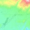
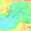
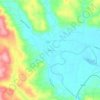
Vader topographic map

Click on the map to display elevation.

About this map

Name: Vader topographic map, elevation, terrain.

Location: Vader, Lewis County, Washington, 98593, United States (46.39500 -122.96641 46.41283 -122.94544)

Average elevation: 75 m

Minimum elevation: 27 m

Maximum elevation: 191 m

Other topographic maps

Click on a map to view its topography, its elevation and its terrain.
Randle

United States > Washington > Lewis County

Average elevation: 378 m

Cinebar

United States > Washington > Lewis County

Average elevation: 308 m

The Rockies

United States > Washington > Lewis County

Average elevation: 1,012 m

Silver Falls

United States > Washington > Lewis County

Average elevation: 847 m

Angry Mountain

United States > Washington > Lewis County

Average elevation: 1,401 m

Onalaska

United States > Washington > Lewis County

Average elevation: 170 m

Packwood

United States > Washington > Lewis County

Average elevation: 379 m

Adna

United States > Washington > Lewis County

Average elevation: 82 m

Mayfield

United States > Washington > Lewis County

Average elevation: 223 m

Bunker

United States > Washington > Lewis County

Average elevation: 101 m

Ceres

United States > Washington > Lewis County

Average elevation: 123 m

Glenoma

United States > Washington > Lewis County

Average elevation: 354 m

Randle

United States > Washington > Lewis County

Average elevation: 378 m

Gear up for your next adventure:

🧥Down Jackets - Insulated jackets for cold weather
🎒3L Hydration Reservoirs - Hands-free drinking to stay hydrated on steep contour climbs
☕Outdoor Coffee Makers - Enjoy quality coffee at the summit of your favorite peak
🔭Compact Hiking Binoculars - Lightweight optics for scouting routes or birdwatching
🧯Animal Deterrent Spray - Safety spray for wildlife

As an Amazon Associate, this site earns from qualifying purchases at no extra cost to you.