
Make a donation
Gear up for your next adventure:
As an Amazon Associate, this site earns from qualifying purchases at no extra cost to you.
Hamshire topographic map
Click on the map to display elevation.
Make a donation
Gear up for your next adventure:
As an Amazon Associate, this site earns from qualifying purchases at no extra cost to you.
About this map
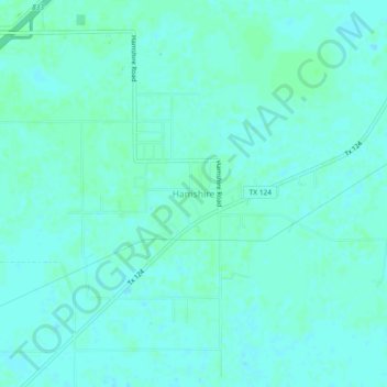
Name: Hamshire topographic map, elevation, terrain.
Location: Hamshire, Jefferson County, Texas, 77622, United States (29.84161 -94.33241 29.88161 -94.29241)
Average elevation: 6 m
Minimum elevation: 3 m
Maximum elevation: 10 m
Make a donation
Gear up for your next adventure:
As an Amazon Associate, this site earns from qualifying purchases at no extra cost to you.
Other topographic maps
Click on a map to view its topography, its elevation and its terrain.
Port Arthur
United States > Texas > Jefferson County
Port Arthur sits in a low-lying coastal area of the Gulf Coast, characterized by its flat, marshy terrain. The city is located at an average elevation of just 8 feet (2 meters) above sea level, with parts of the surrounding region even closer to sea level. Its topography is dominated by wetlands, tidal…
Average elevation: 2 m
Make a donation
Gear up for your next adventure:
As an Amazon Associate, this site earns from qualifying purchases at no extra cost to you.
Groves
United States > Texas > Jefferson County
According to the United States Census Bureau, Groves has an area of 5.2 square miles (13.4 km2), of which 0.015 square miles (0.04 km2), or 0.28%, is water. Most of the city sits at an elevation of 5 to 15 feet (1.5 to 4.6 m) above sea level.
Average elevation: 4 m
Make a donation
Gear up for your next adventure:
As an Amazon Associate, this site earns from qualifying purchases at no extra cost to you.