
Hageland topographic map
Interactive map
Click on the map to display elevation.
About this map
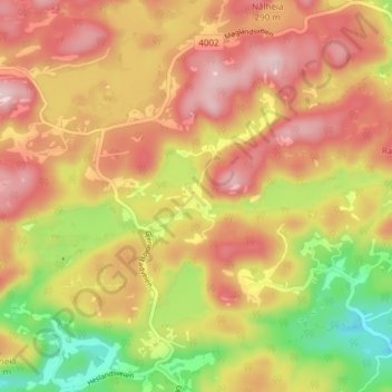
Name: Hageland topographic map, elevation, terrain.
Location: Hageland, Lindesnes, Agder, 4517, Noorwegen (58.06030 7.42756 58.10030 7.46756)
Average elevation: 170 m
Minimum elevation: 27 m
Maximum elevation: 278 m
Other topographic maps
Click on a map to view its topography, its elevation and its terrain.