
Kangra topographic map
Interactive map
Click on the map to display elevation.
About this map
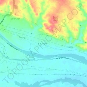
Name: Kangra topographic map, elevation, terrain.
Location: Kangra, ضلع میرپور, Azad Cachemire, 10250, Pakistan (33.08563 73.66237 33.12563 73.70237)
Average elevation: 278 m
Minimum elevation: 247 m
Maximum elevation: 355 m