
Sehmatal topographic map
Interactive map
Click on the map to display elevation.
About this map
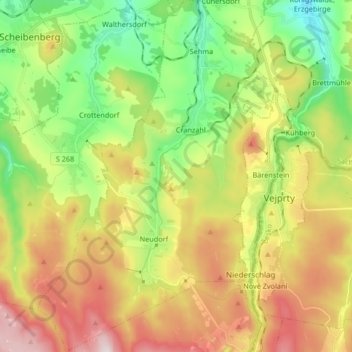
Name: Sehmatal topographic map, elevation, terrain.
Location: Sehmatal, Erzgebirgskreis, Saxony, 09465, Germany (50.44575 12.91791 50.55129 13.03084)
Average elevation: 746 m
Minimum elevation: 528 m
Maximum elevation: 1,041 m