
Κρήτη topographic map
Interactive map
Click on the map to display elevation.
About this map
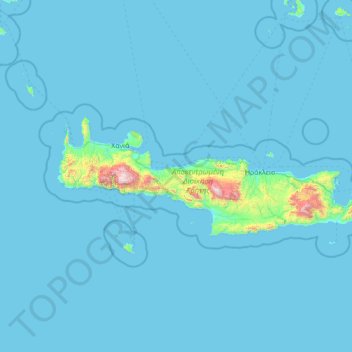
Name: Κρήτη topographic map, elevation, terrain.
Location: Κρήτη, Αποκεντρωμένη Διοίκηση Κρήτης, Grécia (34.92121 23.51448 35.69578 26.31897)
Average elevation: 57 m
Minimum elevation: 0 m
Maximum elevation: 2,440 m
Other topographic maps
Click on a map to view its topography, its elevation and its terrain.
Δήμος Χανίων
Grécia > Αποκεντρωμένη Διοίκηση Κρήτης > Δήμος Χανίων
Δήμος Χανίων, Περιφερειακή Ενότητα Χανίων, Περιφέρεια Κρήτης, Αποκεντρωμένη Διοίκηση Κρήτης, Grécia
Average elevation: 353 m