
Vung Tau City topographic map
Interactive map
Click on the map to display elevation.
About this map
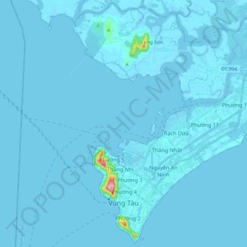
Name: Vung Tau City topographic map, elevation, terrain.
Location: Vung Tau City, Bà Rịa - Vũng Tàu Province, Vietnam (10.32030 107.04181 10.48418 107.21176)
Average elevation: 3 m
Minimum elevation: -9 m
Maximum elevation: 245 m
Other topographic maps
Click on a map to view its topography, its elevation and its terrain.
Côn Sơn Island
Vietnam > Bà Rịa - Vũng Tàu Province > Con Dao
Côn Sơn Island, Con Dao, Côn Đảo District, Bà Rịa - Vũng Tàu Province, Vietnam
Average elevation: 2 m
Green Island
Vietnam > Bà Rịa - Vũng Tàu Province
Green Island, Bà Rịa - Vũng Tàu Province, Vietnam
Average elevation: 1 m