
Marktgemeinde Steinach am Brenner topographic map
Interactive map
Click on the map to display elevation.
About this map
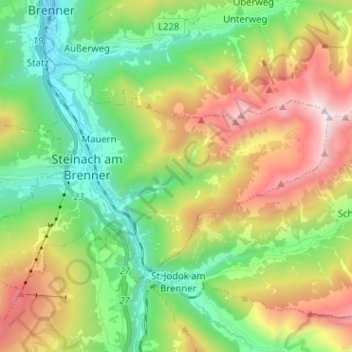
Name: Marktgemeinde Steinach am Brenner topographic map, elevation, terrain.
Average elevation: 1,523 m
Minimum elevation: 985 m
Maximum elevation: 2,412 m
Other topographic maps
Click on a map to view its topography, its elevation and its terrain.
Gemeinde Gnadenwald
Austria > Tyrol > Bezirk Innsbruck-Land
Gemeinde Gnadenwald, Bezirk Innsbruck-Land, Tyrol, 6069, Austria
Average elevation: 1,277 m
Marktgemeinde Wattens
Austria > Tyrol > Bezirk Innsbruck-Land > Marktgemeinde Wattens
Marktgemeinde Wattens, Bezirk Innsbruck-Land, Tyrol, 6112, Austria
Average elevation: 1,040 m