
Central Transdanubia topographic map
Interactive map
Click on the map to display elevation.
About this map
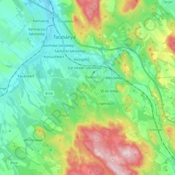
Name: Central Transdanubia topographic map, elevation, terrain.
Location: Central Transdanubia, Transdanubia, 2800, Hungary (47.48643 18.33837 47.60974 18.49780)
Average elevation: 240 m
Minimum elevation: 134 m
Maximum elevation: 491 m
Other topographic maps
Click on a map to view its topography, its elevation and its terrain.