
Riebelsdorf topographic map
Interactive map
Click on the map to display elevation.
About this map
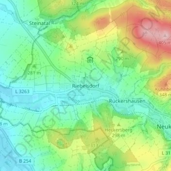
Name: Riebelsdorf topographic map, elevation, terrain.
Average elevation: 276 m
Minimum elevation: 216 m
Maximum elevation: 402 m
Other topographic maps
Click on a map to view its topography, its elevation and its terrain.
Oberaula
Duitsland > Hessen > Schwalm-Eder-Kreis
Oberaula, Schwalm-Eder-Kreis, Hessen, 36280, Duitsland
Average elevation: 412 m