Geolocate

Southwick topographic map

Click on the map to display elevation.

About this map
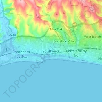
Name: Southwick topographic map, elevation, terrain.

Location: Southwick, Adur, West Sussex, England, BN42 4FY, United Kingdom (50.79453 -0.27833 50.87453 -0.19833)

Average elevation: 32 m

Minimum elevation: -4 m

Maximum elevation: 167 m

Other topographic maps

Click on a map to view its topography, its elevation and its terrain.

Sompting

United Kingdom > England > West Sussex > Adur

Average elevation: 57 m

Lancing

United Kingdom > England > West Sussex > Adur

Average elevation: 18 m

Gear up for your next adventure:

🧭Military Style Lensatic Compass - Durable sighting compasses for advanced land navigation and surveying
🌬️Windbreaker Jackets - Wind protection jackets
🚁Camera Drones with GPS - Capture aerial views of the landscape to compare with topo maps
📕Hiking Guide Books - Guides for hiking trails
🎒Daypacks - Compact backpacks for short hikes

As an Amazon Associate, this site earns from qualifying purchases at no extra cost to you.