
Aalberg topographic map
Interactive map
Click on the map to display elevation.
About this map
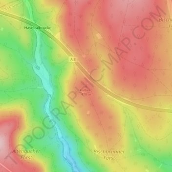
Name: Aalberg topographic map, elevation, terrain.
Average elevation: 425 m
Minimum elevation: 294 m
Maximum elevation: 520 m
Other topographic maps
Click on a map to view its topography, its elevation and its terrain.
Aalberg
Allemagne > Bavière > Bischbrunn
Aalberg, Bischbrunn, Verwaltungsgemeinschaft Marktheidenfeld, Landkreis Main-Spessart, Bavière, Allemagne
Average elevation: 480 m