Geolocate

Janjheli topographic map

Click on the map to display elevation.

About this map
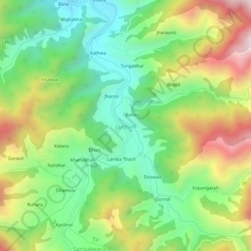
Name: Janjheli topographic map, elevation, terrain.

Location: Janjheli, Thunag, Mandi, Himachal Pradesh, 175047, India (31.49678 77.20141 31.53678 77.24141)

Average elevation: 2,282 m

Minimum elevation: 1,960 m

Maximum elevation: 2,787 m

Gear up for your next adventure:

🎒Tactical Waist Packs - Quick access to your compass, phone, and snacks while walking
⌚Altimeter Barometer Watches - Outdoor watches with built-in sensors to track altitude changes and weather shifts
📦Crushproof Equipment Cases - Safe transport for sensitive surveying and mapping instruments
🏫Topographic World Globes - 3D physical relief globes to understand global geography
📡Weather Radios - Emergency weather radios

As an Amazon Associate, this site earns from qualifying purchases at no extra cost to you.