
Make a donation
Gear up for your next adventure:
As an Amazon Associate, this site earns from qualifying purchases at no extra cost to you.
Hochgrat topographic map
Click on the map to display elevation.
Make a donation
Gear up for your next adventure:
As an Amazon Associate, this site earns from qualifying purchases at no extra cost to you.
Hochgrat
Für eine üppige und artenreiche Gebirgsflora bietet der Hochgrat günstige Voraussetzungen: Sein kalkreiches Nagelfluhgestein ist mit Sandstein- und Mergelschichten durchsetzt, so dass den Pflanzen ein breites Spektrum an Mineralien und Substratstrukturen zur Verfügung steht. Die klimatische Ausgesetztheit der Nagelfluhkette sorgt für häufige Niederschläge und für viel Wind. Mit seiner Höhe erreicht der Hochgrat die Waldgrenze (etwa 1.800 m), was einige mit Bäumen konkurrierende Gebirgsblumen begünstigt.
Make a donation
Gear up for your next adventure:
As an Amazon Associate, this site earns from qualifying purchases at no extra cost to you.
About this map
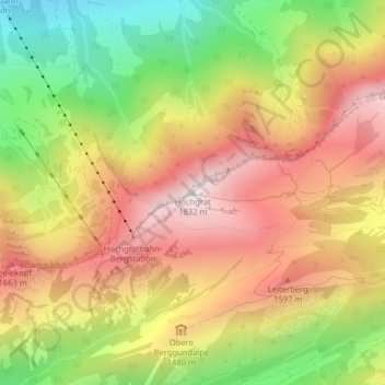
Name: Hochgrat topographic map, elevation, terrain.
Average elevation: 1,388 m
Minimum elevation: 896 m
Maximum elevation: 1,818 m
Make a donation
Gear up for your next adventure:
As an Amazon Associate, this site earns from qualifying purchases at no extra cost to you.