
Thank you for supporting this site ❤️
Make a donation
Make a donation
Gear up for your next adventure:
As an Amazon Associate, this site earns from qualifying purchases at no extra cost to you.
Ruaraka topographic map
Click on the map to display elevation.
Thank you for supporting this site ❤️
Make a donation
Make a donation
Gear up for your next adventure:
As an Amazon Associate, this site earns from qualifying purchases at no extra cost to you.
About this map
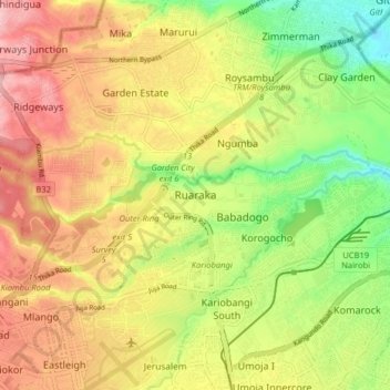
Name: Ruaraka topographic map, elevation, terrain.
Location: Ruaraka, Nairobi, Nairobi County, 00620, Kenya (-1.28299 36.83562 -1.20299 36.91562)
Average elevation: 1,616 m
Minimum elevation: 1,533 m
Maximum elevation: 1,694 m
Thank you for supporting this site ❤️
Make a donation
Make a donation
Gear up for your next adventure:
As an Amazon Associate, this site earns from qualifying purchases at no extra cost to you.