Geolocate

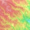
Yorkshire topographic map

Click on the map to display elevation.

About this map

Name: Yorkshire topographic map, elevation, terrain.

Location: Yorkshire, Prince William County, Virginia, 20111, United States (38.77054 -77.47328 38.80395 -77.43274)

Average elevation: 67 m

Minimum elevation: 41 m

Maximum elevation: 104 m

Other topographic maps

Click on a map to view its topography, its elevation and its terrain.

Antioch

United States > Virginia > Prince William County

Average elevation: 199 m

Gear up for your next adventure:

🥾Heavy Duty Hiking Boots - Ankle-supporting boots for carrying heavy packs on steep contours
🔦Powerful LED Headlamps - Hands-free lighting for night navigation and setting up camp after dark
🧺Fast-Dry Microfiber Towels - Large towels that pack down to the size of an orange
🍴Titanium Spork & Cutlery - Indestructible and feather-light eating utensils
📟Satellite Messengers - Two-way satellite communication to stay in touch beyond the cellular grid

As an Amazon Associate, this site earns from qualifying purchases at no extra cost to you.