Geolocate

Batad topographic map

Click on the map to display elevation.

About this map

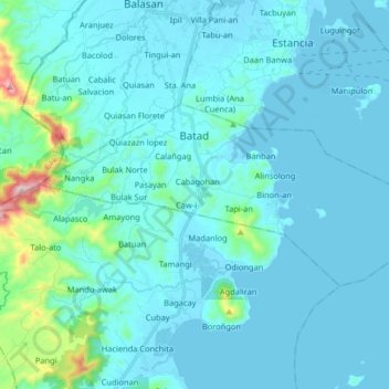
Name: Batad topographic map, elevation, terrain.

Location: Batad, Iloilo, Western Visayas, 5016, Philippines (11.35644 123.04532 11.43099 123.20779)

Average elevation: 56 m

Minimum elevation: -1 m

Maximum elevation: 601 m

Other topographic maps

Click on a map to view its topography, its elevation and its terrain.

Malunang

Philippines > Iloilo > Zarraga

Average elevation: 5 m

Gear up for your next adventure:

🛰️Handheld GPS Units - Rugged GPS devices for tracking coordinates and elevation in the Australian bush
🦘Outback Survival Gear - Essential gear for Australian outback
📱Shockproof Phone Cases - Extra protection for your smartphone against drops on rocky terrain
📦Crushproof Equipment Cases - Safe transport for sensitive surveying and mapping instruments
🦟Insect Repellent - Protection against insects

As an Amazon Associate, this site earns from qualifying purchases at no extra cost to you.