
Tiu Chung Pai topographic map
Interactive map
Click on the map to display elevation.
About this map
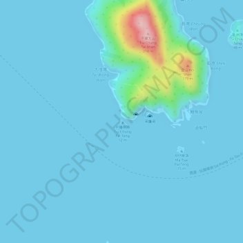
Name: Tiu Chung Pai topographic map, elevation, terrain.
Location: Tiu Chung Pai, Kau Sai, Sai Kung District, Hong Kong, PRC (22.32565 114.31976 22.32631 114.32063)
Average elevation: 15 m
Minimum elevation: -3 m
Maximum elevation: 190 m
Other topographic maps
Click on a map to view its topography, its elevation and its terrain.