
Snow Bowl topographic map
Interactive map
Click on the map to display elevation.
About this map
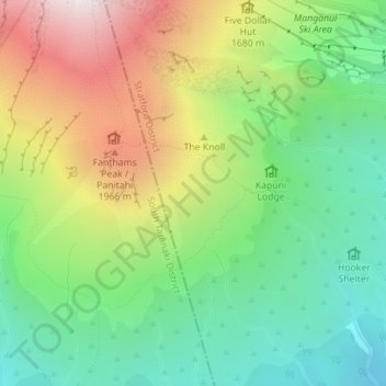
Name: Snow Bowl topographic map, elevation, terrain.
Location: Snow Bowl, Stratford District, Taranaki, New Zealand (-39.32331 174.06321 -39.30331 174.08321)
Average elevation: 1,467 m
Minimum elevation: 928 m
Maximum elevation: 2,321 m