
Make a donation
Gear up for your next adventure:
As an Amazon Associate, this site earns from qualifying purchases at no extra cost to you.
Touga topographic map
Click on the map to display elevation.
Make a donation
Gear up for your next adventure:
As an Amazon Associate, this site earns from qualifying purchases at no extra cost to you.
About this map
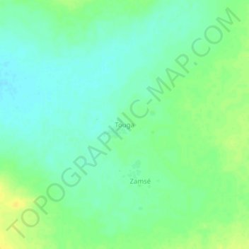
Name: Touga topographic map, elevation, terrain.
Location: Touga, Bam, Central-North, Burkina Faso (13.43638 -1.81429 13.47638 -1.77429)
Average elevation: 334 m
Minimum elevation: 325 m
Maximum elevation: 346 m
Make a donation
Gear up for your next adventure:
As an Amazon Associate, this site earns from qualifying purchases at no extra cost to you.
Other topographic maps
Click on a map to view its topography, its elevation and its terrain.
Sahel
Most of Burkina Faso is a wide plateau formed by riverine systems and is called Falaise de Banfora. There are three major rivers, the Red Volta, Black Volta and White Volta, which cuts through different valleys. The climate is generally hot, with unreliable rains across different seasons. Gold and quartz are…
Average elevation: 294 m
Waterfalls
Most of Burkina Faso is a wide plateau formed by riverine systems and is called falaise de Banfora. There are three major rivers, the Red Volta, Black Volta and White Volta, which cuts through different valleys. The climate is generally hot, with unreliable rains across different seasons. Gold and quartz are…
Average elevation: 338 m
Make a donation
Gear up for your next adventure:
As an Amazon Associate, this site earns from qualifying purchases at no extra cost to you.
Upper-Basins
Most of Burkino Faso is a wide plateau formed by riverine systems and is called falaise de Banfora. There are three major rivers, the Red Volta, Black Volta and White Volta, which cuts through different valleys. The climate is generally hot, with unreliable rains across different seasons. Gold and quartz are…
Average elevation: 330 m