
Vieux-Fort topographic map
Interactive map
Click on the map to display elevation.
About this map
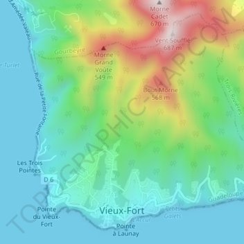
Name: Vieux-Fort topographic map, elevation, terrain.
Location: Vieux-Fort, Basse-Terre, Guadeloupe, 97141, France (15.94645 -61.71013 15.97497 -61.67678)
Average elevation: 180 m
Minimum elevation: 0 m
Maximum elevation: 641 m
Other topographic maps
Click on a map to view its topography, its elevation and its terrain.