
Louiseville topographic map
Interactive map
Click on the map to display elevation.
About this map
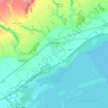
Name: Louiseville topographic map, elevation, terrain.
Location: Louiseville, Maskinongé (MRC), Mauricie, Quebec, Kanada (46.18079 -73.03235 46.29571 -72.79100)
Average elevation: 17 m
Minimum elevation: 1 m
Maximum elevation: 87 m