
Fontanar topographic map
Interactive map
Click on the map to display elevation.
About this map
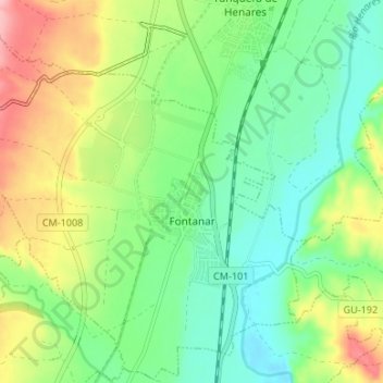
Name: Fontanar topographic map, elevation, terrain.
Location: Fontanar, Guadalajara, Castilla-La Mancha, España (40.70518 -3.22198 40.75471 -3.15527)
Average elevation: 708 m
Minimum elevation: 648 m
Maximum elevation: 815 m