
洛吉乡 topographic map
Interactive map
Click on the map to display elevation.
About this map
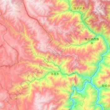
Name: 洛吉乡 topographic map, elevation, terrain.
Location: 洛吉乡, 香格里拉市, 迪庆藏族自治州, 云南省, 中国 (27.64478 99.91438 28.10296 100.30793)
Average elevation: 3,201 m
Minimum elevation: 1,468 m
Maximum elevation: 4,679 m
洛吉乡位于中国云南省香格里拉县东部,东靠四川省木里县俄雅乡,东南与丽江市奉科乡隔金沙江相望,西与建塘镇毗邻,北与四川省稻城县东尼乡和本县格咱乡相连。乡政府驻地洛吉村中村距县城86公里,海拔2130米。全乡地势西高东低,气候随海拔高度变化明显,年均降雨量为760毫米。目前全乡辖九龙、洛吉、尼汝三个村委会。
Other topographic maps
Click on a map to view its topography, its elevation and its terrain.