Geolocate

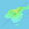
Dronninglund topographic map

Click on the map to display elevation.

About this map

Name: Dronninglund topographic map, elevation, terrain.

Location: Dronninglund, Brønderslev Municipality, North Denmark Region, 9330, Denmark (57.13830 10.27009 57.17830 10.31009)

Average elevation: 23 m

Minimum elevation: 9 m

Maximum elevation: 57 m

Other topographic maps

Click on a map to view its topography, its elevation and its terrain.

Skivum

Denmark > North Denmark Region

Average elevation: 32 m

Pebermosen

Denmark > North Denmark Region > Grindsted > Vandsted

Average elevation: 39 m

Læsø

Denmark > North Denmark Region

Average elevation: 1 m

Lindholm Høje

Denmark > North Denmark Region > Aalborg

Average elevation: 14 m

Vendsyssel

Denmark > North Denmark Region

Average elevation: 10 m

Mors

Denmark > North Denmark Region

Average elevation: 12 m

Bulbjerg

Denmark > North Denmark Region

Average elevation: 8 m

Egholm

Denmark > North Denmark Region > Aalborg

Average elevation: 1 m

Gear up for your next adventure:

🧢Outdoor Sun Hats - Sun protection hats for hiking
🔥Ferrocerium Rod Fire Starters - Reliable fire lighting in wet or windy conditions without matches
🍴Titanium Spork & Cutlery - Indestructible and feather-light eating utensils
🦟Insect Repellent - Protection against insects
🔦LED Torches - LED torches for outdoor use

As an Amazon Associate, this site earns from qualifying purchases at no extra cost to you.