Geolocate

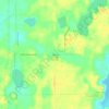
Solon Township topographic map

Click on the map to display elevation.

About this map

Name: Solon Township topographic map, elevation, terrain.

Location: Solon Township, Kent County, Michigan, United States (43.20502 -85.67294 43.29426 -85.55107)

Average elevation: 263 m

Minimum elevation: 228 m

Maximum elevation: 324 m

Other topographic maps

Click on a map to view its topography, its elevation and its terrain.
Cascade

United States > Michigan > Kent County

Average elevation: 222 m

Harvard Lake

United States > Michigan > Kent County > Harvard

Average elevation: 267 m

Grattan

United States > Michigan > Kent County

Average elevation: 261 m

Ada

United States > Michigan > Kent County

Average elevation: 208 m

Kettle Lake

United States > Michigan > Kent County

Average elevation: 239 m

Ada

United States > Michigan > Kent County

Average elevation: 208 m

Cobb Lake

United States > Michigan > Kent County > Bowne Township

Average elevation: 252 m

Grattan

United States > Michigan > Kent County > Grattan Township

Average elevation: 261 m

Parnell

United States > Michigan > Kent County > Grattan Township

Average elevation: 259 m

Gear up for your next adventure:

👣Snake & Scrub Gaiters - Protection against spinifex, mud, and snakes while walking off-track
🥤Hydration Packs - Hydration systems for hiking
🪫Rechargeable Headlamps - USB rechargeable headlamps
🧴Sunscreen SPF - Sun protection for outdoor activities
🔦Powerful LED Headlamps - Hands-free lighting for night navigation and setting up camp after dark

As an Amazon Associate, this site earns from qualifying purchases at no extra cost to you.