
Lysá pod Makytou topographic map
Interactive map
Click on the map to display elevation.
About this map
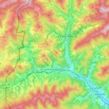
Name: Lysá pod Makytou topographic map, elevation, terrain.
Average elevation: 558 m
Minimum elevation: 305 m
Maximum elevation: 884 m
The municipality lies at an altitude of 415 metres and covers an area of 33.402 km². It has a population of about 2,170 people.