
Mawsynram topographic map
Interactive map
Click on the map to display elevation.
About this map
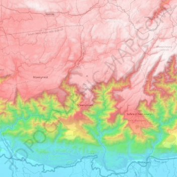
Name: Mawsynram topographic map, elevation, terrain.
Location: Mawsynram, East Khasi Hills, Meghalaya, India (25.13479 91.36505 25.55464 91.75198)
Average elevation: 1,107 m
Minimum elevation: 7 m
Maximum elevation: 1,929 m
Other topographic maps
Click on a map to view its topography, its elevation and its terrain.