
Villanueva topographic map
Interactive map
Click on the map to display elevation.
About this map
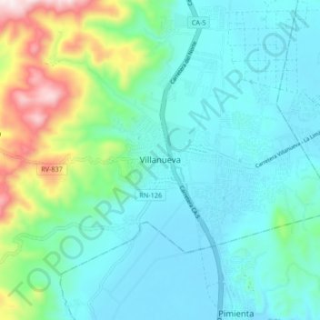
Name: Villanueva topographic map, elevation, terrain.
Location: Villanueva, Cortés, Honduras (15.27570 -88.03323 15.35570 -87.95323)
Average elevation: 171 m
Minimum elevation: 39 m
Maximum elevation: 669 m
Other topographic maps
Click on a map to view its topography, its elevation and its terrain.
El Milagro
Honduras > Cortés > Villanueva
El Milagro, Villanueva, Cortés, Honduras
Average elevation: 80 m