
簕竹镇 topographic map
Interactive map
Click on the map to display elevation.
About this map
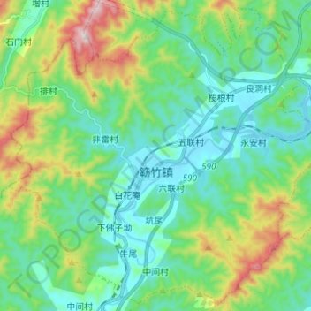
Name: 簕竹镇 topographic map, elevation, terrain.
Location: 簕竹镇, 新兴县, 云浮市, 广东省, 中国 (22.65051 112.05685 22.75755 112.17865)
Average elevation: 193 m
Minimum elevation: 29 m
Maximum elevation: 664 m
Other topographic maps
Click on a map to view its topography, its elevation and its terrain.