
Державинск topographic map
Interactive map
Click on the map to display elevation.
About this map
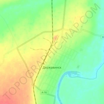
Name: Державинск topographic map, elevation, terrain.
Average elevation: 251 m
Minimum elevation: 229 m
Maximum elevation: 278 m
Other topographic maps
Click on a map to view its topography, its elevation and its terrain.
Зерноградское
Казахстан > Акмолинская область > Жаркаинский район
Зерноградское, Жаркаинский район, Акмолинская область, 021107, Казахстан
Average elevation: 294 m