
Diets-Heur topographic map
Interactive map
Click on the map to display elevation.
About this map
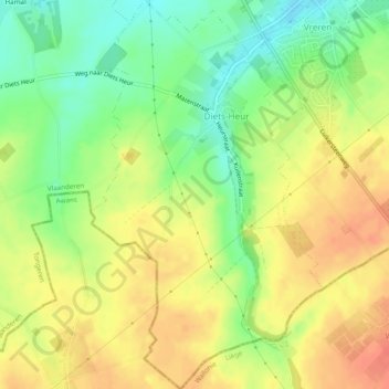
Name: Diets-Heur topographic map, elevation, terrain.
Location: Diets-Heur, Tongeren, Limburg, Vlaanderen, België (50.72353 5.46748 50.75412 5.49637)
Average elevation: 124 m
Minimum elevation: 94 m
Maximum elevation: 152 m
Diets-Heur bevindt zich in droog-Haspengouw op een hoogte van 97 tot 137 meter. De enige waterloop is het beekje de Buth, dat in noordoostelijke richting stroomt. Het dorp ligt aan de taalgrens.
Other topographic maps
Click on a map to view its topography, its elevation and its terrain.