
上桂河 topographic map
Interactive map
Click on the map to display elevation.
About this map
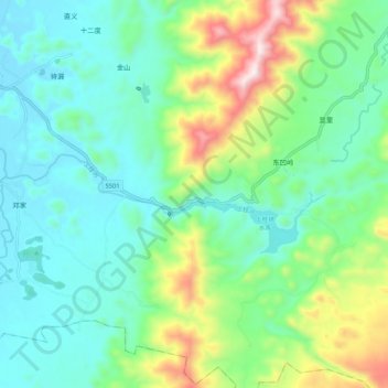
Name: 上桂河 topographic map, elevation, terrain.
Location: 上桂河, 兴安县, 桂林市, 广西壮族自治区, 中国 (25.38039 110.59741 25.40002 110.70331)
Average elevation: 452 m
Minimum elevation: 257 m
Maximum elevation: 1,001 m
Other topographic maps
Click on a map to view its topography, its elevation and its terrain.