
Innerkrems topographic map
Interactive map
Click on the map to display elevation.
About this map
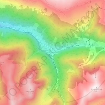
Name: Innerkrems topographic map, elevation, terrain.
Average elevation: 1,811 m
Minimum elevation: 1,374 m
Maximum elevation: 2,161 m
Other topographic maps
Click on a map to view its topography, its elevation and its terrain.
Pleßnitz
Österreich > Kärnten > Bezirk Spittal an der Drau > Krems in Kärnten > Densdorf
Pleßnitz, Densdorf, Krems in Kärnten, Bezirk Spittal an der Drau, Kärnten, 9861, Österreich
Average elevation: 1,273 m