Geolocate
👉 Easily get elevation data in JSON, GeoTIFF and KML formats using Elevation API
Thank you for supporting this site ❤️
Make a donation

Coosebean topographic map

Click on the map to display elevation.

About this map

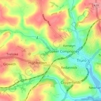
Name: Coosebean topographic map, elevation, terrain.

Location: Coosebean, Truro, Cornwall, England, TR4 9EA, United Kingdom (50.24720 -5.09115 50.28720 -5.05115)

Average elevation: 54 m

Minimum elevation: -1 m

Maximum elevation: 111 m

Gear up for your next adventure:

🧥Softshell Jackets - Flexible outdoor jackets
🕯️Emergency Whistles - Safety whistles for hiking
🧊Insulated Cooler Bags - Keep food fresh for day trips to remote geographic sites
🧳Outdoor Travel Organizers - Gear organization accessories
📡Weather Radios - Emergency weather radios

As an Amazon Associate, this site earns from qualifying purchases at no extra cost to you.