Geolocate

Red Rock topographic map

Click on the map to display elevation.

About this map

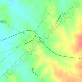
Name: Red Rock topographic map, elevation, terrain.

Location: Red Rock, Bastrop County, Texas, 78662, United States (29.93967 -97.46611 29.97967 -97.42611)

Average elevation: 152 m

Minimum elevation: 130 m

Maximum elevation: 183 m

Other topographic maps

Click on a map to view its topography, its elevation and its terrain.

Cedar Creek

United States > Texas > Bastrop County

Average elevation: 125 m

Smithville

United States > Texas > Bastrop County

Average elevation: 100 m

Smithville

United States > Texas > Bastrop County

Average elevation: 100 m

Line Creek

United States > Texas > Bastrop County

Average elevation: 130 m

Bastrop

United States > Texas > Bastrop County

Average elevation: 129 m

Smithville

United States > Texas > Bastrop County

Average elevation: 100 m

Gear up for your next adventure:

🪫Rechargeable Headlamps - USB rechargeable headlamps
🧴SPF 50+ Bulk Sunscreen - Maximum protection for long-term outdoor exposure
📸Action Cameras - Record your journey across interesting topographic features in 4K
🦶Orthotic Hiking Insoles - Extra arch support for long-distance topographic treks
🦘Outback Survival Gear - Essential gear for Australian outback

As an Amazon Associate, this site earns from qualifying purchases at no extra cost to you.