
Oriolo Romano topographic map
Interactive map
Click on the map to display elevation.
About this map
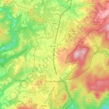
Name: Oriolo Romano topographic map, elevation, terrain.
Location: Oriolo Romano, Viterbo, Lazio, Italy (42.14727 12.08495 42.20201 12.16885)
Average elevation: 414 m
Minimum elevation: 263 m
Maximum elevation: 562 m
Other topographic maps
Click on a map to view its topography, its elevation and its terrain.