
Nilphamari District topographic map
Interactive map
Click on the map to display elevation.
About this map
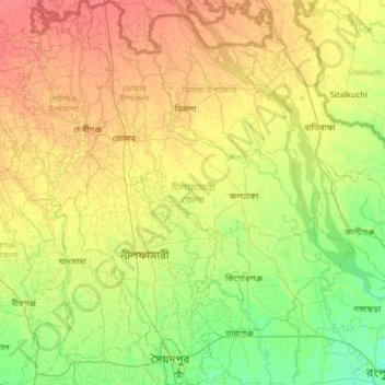
Name: Nilphamari District topographic map, elevation, terrain.
Location: Nilphamari District, Rangpur Division, Bangladesh (25.73930 88.73800 26.31006 89.19651)
Average elevation: 48 m
Minimum elevation: 30 m
Maximum elevation: 71 m
Other topographic maps
Click on a map to view its topography, its elevation and its terrain.
বোদা
Bangladesh > Rangpur Division > বোদা
বোদা, Boda, Panchagarh District, Rangpur Division, Bangladesh
Average elevation: 65 m