
Escates topographic map
Interactive map
Click on the map to display elevation.
About this map
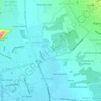
Name: Escates topographic map, elevation, terrain.
Location: Escates, Parcona, Ica, 11000, Perú (-14.07761 -75.73862 -14.03761 -75.69862)
Average elevation: 417 m
Minimum elevation: 401 m
Maximum elevation: 518 m
Other topographic maps
Click on a map to view its topography, its elevation and its terrain.
Sanchez Cerro
Perú > Ica > Parcona > Vista Florida
Sanchez Cerro, Vista Florida, Parcona, Ica, 11000, Perú
Average elevation: 422 m