Geolocate

Elfer topographic map

Click on the map to display elevation.

About this map
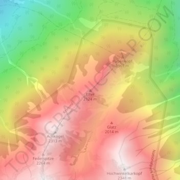
Name: Elfer topographic map, elevation, terrain.

Location: Elfer, Krimml, Bezirk Zell am See, Salzburg, 5743, Austria (47.21845 12.21758 47.21855 12.21768)

Average elevation: 1,735 m

Minimum elevation: 946 m

Maximum elevation: 2,311 m

Gear up for your next adventure:

🥤Outdoor Water Bottles - Reusable bottles for outdoor activities
⌚Altimeter Watches - Watches with altitude tracking
📱Tablet Tripod Mounts - Steady platforms for viewing digital maps or taking long exposures
🎒Hiking Backpacks - Backpacks designed for hiking and trekking
🧺Fast-Dry Microfiber Towels - Large towels that pack down to the size of an orange

As an Amazon Associate, this site earns from qualifying purchases at no extra cost to you.