
General Miguel Alemán (Potrero Nuevo) topographic map
Interactive map
Click on the map to display elevation.
About this map
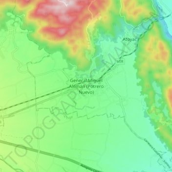
Name: General Miguel Alemán (Potrero Nuevo) topographic map, elevation, terrain.
Average elevation: 565 m
Minimum elevation: 373 m
Maximum elevation: 950 m
Other topographic maps
Click on a map to view its topography, its elevation and its terrain.
La Angostura
México > Veracruz > Atoyac > General Miguel Alemán (Potrero Nuevo)
La Angostura, General Miguel Alemán (Potrero Nuevo), Atoyac, Veracruz, 94966, México
Average elevation: 536 m